Sub-Header

I wanted to put a link to the original Adventure Time clip on youtube here, but I can't find it. Here's one elsewhere, I think... http://www.funnyjunk.com/movies/1130587/
Your life will be richer for watching it ;)

Thursday, 28 February 2013

Glenorchy


Today, I rode a horse through a roundabout.
The horse's name was Pete.
This is Pete:

Just a quick post today, though I've got a whole list of things I want to ramble about (need to be up early tomorrow morning thus I want to go to bed now :p ). Today we headed up to the lovely little town of Glenorchy: population, a few hundred... with about two or three horses to each person. Main industry: take tourists riding and provided land and horses for movies, including The Lord of the Rings, The Hobbit, The Chronicles of Narnia (Prince Caspian), and Wolverine (when he was supposed to be in Alberta. They forgot to take the arrows off the roads in the film though, so you can tell that Wolverine is driving on the wrong side of the road. haha. I remember when they turned Buchanan Tower into an evil warlord's headquarters for that movie, complete with several dump trucks full of red sand...)

The ride took us through the Dart river valley, crossing the Rees river and seeing some rather pretty mountains. (We only rode through a roundabout to get back to the stables which were on the other side of town :p ).


Its been a while since I've been on a horse, and this was my first time using an English saddle. I liked it! I also liked Pete. He knew what he was doing. :p

My battery is dead, or very near to it, so hopefully this post will go up before it fully dies.

Tomorrow: Milford Sound!

- Marysa
Pete and Ginger. Look closely at
Ginger's face (Janna's horse). I
laughed. Also, Ginger doesn't get
along with other horses, and that's
about as close as Pete would let him
stand...

Tuesday, 26 February 2013

South of 45

Greetings!
Peter's Pool, Franz Joseph

The Blue Pools
"My word, look at that mountain over yonder!"
"Oh yes, it is quite remarkable."
"My thoughts exactly, remarkable indeed. And the one next to it is remarkably remarkable as well!"
"Precisely. Highly remarkable!"

Enough of that. We spent the day in Queenstown today, which is a mid-sized town (big enough for groceries, small enough to walk everywhere) on a great big twisty lake in the Otago region of the South Island, whose population appears to be mostly composed of tourists. It sits near the foothills of a mountain range which, if it still had snow on it, would bear a remarkable (ha, ha) resemblance to the Steeples back home. Why all the use of the word remarkable, you ask? They named the range "the Remarkables." I'm not sure why I find this so entertaining, but I do. Also, there are not actually any pictures of them in this post. Maybe next time :p .

I realized on the drive here that it is very lucky for me that I have access to google, and wikipedia. :p A few hundred years ago, if I wanted to know if eels could jump, I'd have to a) get to a library and b) spend hours or weeks or months trying to find a book (if one existed) answering my question. Except I probably wouldn't even have that many questions... I'd probably be a young madam who'd never even heard of an eel. What prompts this thought? More than eels. (See next paragraph.)

The drive to Queenstown took us through Mount Aspiring National Park. We stopped at one of the many trails dotting the highway and took a path leading down to the Blue Pools (quite pretty). Along the way, there was a tree which had fallen across the path, and been cut away. Something was odd about the tree, though. It didn't have any growth rings! How am I supposed to count how old it is? Now, I know the growth rings happen because of seasonal changes, but I hadn't thought much before about trees in places where there is very little seasonal fluctuation. But even then, most places still have a wet and dry season, even right near the equator! I mean, the Earth is tilted - there's got to be some minute difference in climate over the course of a year pretty much everywhere on Earth. Or is there? Google to the rescue! It turns out that there are some trees which grow at pretty much the same rate throughout the year and don't exhibit any visible growth rings. Even these trees, though, actually do have "growth rings" - but they only show up by a chemical analysis.

I checked the first fence post I found. It had tree rings.

We crossed to the south side of the 45th parallel - still not quite as far south as home is north :p. The big news in New Zealand today - apparently there was a shark attack near Auckland today, though they're not sure if the person may already have been dead by the time the shark found him.

Does anyone know what these signs are for? I haven't tried looking it up yet, but they are all over the edges of the highway. Sometimes the reflector circles are in the middle, or on the side, or in a corner, or even on the post! Sometimes the sign is portrait-style, sometimes landscape. There is nothing on the back of the sign. Does it mean something? Secret trucker-code? Surveying? Signify something down the road? This doesn't seem likely since sometimes there is one on either side, facing opposite directions. Its been driving me nuts. There is a website for a road construction company on a sticker on one... maybe I'll email them and ask...

Tomorrow: Glenorchy! We're going horse back riding! (Its been a while since I've been on a horse...)

- Marysa

PS - I've posted some photos onto my Flickr.

Monday, 25 February 2013

Icy Eels


EELS!

I'll get to that later.

After wandering around Hokitika for a while this morning, we continued to head south... but not before feeding Tuck. Of course, we'd fed the car not long before we got to Hokitika, but we figured we might as well top up the tank. Turns out we could only fit about 3.5 litres in the tank. The lady at the till had a good chuckle that we bothered filling up at all. I mean, I feel like its pretty normal at home for people to stick 5 or 10 dollars in the tank, but gas is quite expensive down here and $5 really won't get you that far.

About five minutes later we realized we forgot to take advantage of the squeegees (I hadn't realized how awesomely that is spelled until now), so our windows remained rather dirty. Whoopsy. Another whoopsy - my headband disappeared (off my head) somewhere in Hokitika, much to my chagrin. Hair in face, pah. :|

The typically twisting road wound south, pulling a little more inland than previously. And we saw mountains. Real mountains! (No offence to the hillier mountains of the north). Mountains with an actual tree line, and snowy peaks!

We stopped for lunch at a mirror smooth lake,
Lake full of eels!
and ate sitting on the end of a dock. From which we could easily observe the local flora and fauna... lakeweed, a few little minnows, some clam-like creatures, and, half hidden in the weeds, trying to open up the clams - EELS. A LOT of eels! There aren't any eels at the lakes at home, are there? As we were sitting with our feet dangling over the edge of the dock, we started wondering if eels could jump, like normal fish. Maybe to jump up and bite our toes. And swim away with them. That would be unfortunate for my feet...
One of the waterfalls in the Franz Josef glacier
valley

Just googled it. Apparently its a problem for people who keep eels as pets (pets?) They have a tendency to leap out of their tank...

Sometimes on the road there's a bit of construction - but not always a person with the stop-go sign; instead, they've got automated street lights set up. Also, most of the bridges are only single lane, with one direction getting the right of way. One section of road was pretty long and windy - just a single lane, again with the street lights telling you if you get to go. And a not-so-comforting sign saying "if lights not working, proceed with caution" :p . But the main reason I mentioned construction was because Janna, when she sees the machinery down here, says "aw, its so cute!" For those unaware, Janna's been working up in Fort Mac, where the trucks are GIGANTIC.

layered limestone near the
Franz Josef glacier
There are dandelion-like plants down here. The flowers look the same but the stems are long - up to a few feet long. Peculiar. I think a botanist would be like a kid in a candy store down here. Moreover, there are a lot of really cool rocks. And generally awesome geological formations. Don't worry, I'm not about to switch to a geology program. :p

We saw the Franz-Josef glacier today - just from a distance.
Its been rapidly retreating over the past 150 years, though usually exhibits advance-retreat behaviour (but flowing a lot more quickly than your average glacier). Though it was an overcast day, most of it was visible through the clouds. The valley into which it flows is extremely lush, with multiple waterfalls cascading down the cliff faces. Fantastic "glacial" blues near the bottom, a big snow field on top, and lots of rocks piled on the middle :)

Some cautionary
signs posted along
the trail
There is a lot of unstable rock closer to the glacier - its been torn up by the rapid retreat. What looks like a pile of gravel is actually hiding a big (unstable) limestone arch! (Hard to tell the scale of this formation from the picture. You could fit an excavator inside the arch no problem.)

We stopped for a pint (rather, Janna did. I did have a sip, and it wasn't too bad. I had a delicious concoction of ginger beer, lime, and mint leaves, mmmmm). Some of the other people in the current hostel are watching Wedding Crashers - I had forgotten how funny the movie is. :p

Our watermelon has now been chopped up and a large quantity of it consumed by yours truly :)

Until next time,

Marysa

Sunday, 24 February 2013

The Outside World

edit: my apologies if anyone got email-spammed from google+ , it pops up every time I post and in my attempt to hit "skip" I may have unintentionally sent a large number of people an email instead...

17 mile, on the west coast
Neither Janna nor myself is actually certain on the pronunciation of Motueka, but however it is pronounced, they have a pretty awesome farmer's market on Sunday mornings. Which was this morning (here, anyhow :p ). The proud new owners of an awesome llama finger puppet, some tasty carrots, delicious peaches, nasty tomatoes (though Janna thinks they're pretty great), and an as-yet-unsampled watermelon, Janna, Daniel, Tuck, and myself hit the road. (For all of you doing a double take, no, we did not pick up any new travel buddies along with the fruit. Tuck is the car. Daniel is the British voice we have set on the GPS :p ).

I am currently being annoyed my an invisible mosquito.

It was a fairly long drive from Motueka to our next destination - the pancake rocks (not for eating)! The road was (as usual) windy most of the way, but we passed some gorgeous river scenery. Of a river. In a gorge. Ha. Haha. Okay, but in all seriousness, it was very pretty :p .


The mud layer has all washed
away, leaving stacked layers
of limestone


The pancake rocks are some rather unusual limestone formations along the west coast. The limestone parts formed the usual way approximately 35 million years ago, with the exoskeletons of oceanic organisms falling to the sea floor and condensing under enormous pressure. For "reasons not entirely understood", these particular beds of limestone are layered with softer mud/silt sediment. When the plate movement which is currently raising the Southern Alps pushed these limestone beds above sea level (~5 million years ago), the pounding of the waves, rain, and wind began eroding the rock into its current bizarre formations. The mud layers eroded at a much quicker rate than the limestone, resulting in the pancake-like stacks of rock we see today.
The Pancake Rocks

There were some incredible shapes in the rocks - lots of towers, but also huge limestone arches on a truly grand scale, leading to tumultuous surf-filled pools surrounded full-circle by stone at the top. At high tide this results in an assortment of blow holes spewing water high up into the sky (or so the pictures tell me - we missed high tide by several hours :p ).

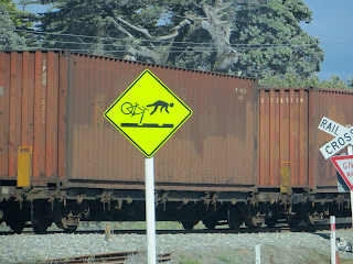
To continue on the theme of amusing road signs, I'll include a couple of good ones from today... penguins and a warning to cyclists about riding over rails.
Caution, penguins next
5 km


Eventually we drove down to the little town of Hokitika - and the last grocery store for 500 and something km! Speaking of grocery stores... well, lets just say that the grocery store here hasn't quite figured out their automatic checkouts. We were headed for the normal tills when a girl who worked there stepped out and asked if we could us the self-checkout, instead. Okay, sure. I use them all the time back in Vancouver. Why not. However, the machine ate our cash then wouldn't dispense the change, and no less than 6 employees (two of whom were managers) milled around for a good 15 minutes before deciding that they didn't know how to fix it and ringing us through a regular till. Grocery trip extended three fold... Also Janna was very excited to make herself an omelet for breakfast tomorrow, but we forgot to buy eggs. Oops. Also also, Janna bought a jug of (alcoholic) cider, and I had a bit and can honestly say its not half bad (what is the world coming to???)

Back at the camp site, a Boy Scout sold us a chocolate bar. Clever of him - so many potential customers in so little space... it was a tasty chocolate bar, and didn't last very long. Which was a pity, because we were supposed to be using it as a bribe to make me send some much-needed emails to the outside world sorting out my situation with graduate school this upcoming semester. (Brief update for those I haven't seen in a while... original plan of UVic has been morphing into the graduate program at UW in Seattle (or Univ. Colorado, Boulder, but its looking like Seattle)). But eventually the emails were sent, even without any chocolate left with which to bribe me.

There is a really large spider behind my bed and while spiders don't normally bother me I don't really want a giant one crawling on my face while I'm sleeping. If I hadn't seen it on the wall a little while ago I would be blissfully ignorant... I wonder if it likes mosquitoes... maybe I can lure it out if I catch the mosquito that's been buzzing around my head for the past little while. Who am I kidding, I'm just going to bed :p

Watch out for spiders,
Marysa

Saturday, 23 February 2013

Boats!

Brace yourselves. This is a long one.


Dark and early yesterday morning, two very sleepy Canadians (and quite possibly more, I wouldn't know) hopped into their car and drove onto a ferry! One of them was me. A very temperamental window that was set on rattling all night may have contributed to the sleepiness. It was a dark and stormy crossing, and I fell asleep. Good story, eh? :p

Then the boat found and island! Back into the car go the Canadians, and onto the South Island we drove. The ferry docked in the lovely little town of Picton. It was here in Picton that I sampled my first New Zealand meat pie. And ohmyitwassogoodandIfeltlikeitwasthesizeofmyheadbutreallyitwasn'tandthey'djustpulleditout oftheovenanditwasreallyreallyreallyreallytasty! Very tasty. I'm not kidding. If you're ever in Picton, go get one of those pies. A short walk around to stretch our legs (who am I kidding, the walk was to give us time to eat the pies - it was a two-handed affair; there's no way I was going to try to eat it while driving :p ).

Apparently the windy roads of the Coromandel were just a warm up for the South Island - a short-but-long drive (100 km, 2 hours ish) led to the town of Nelson. The descriptions of Nelson we heard were uncannily similar to those of BC's Nelson, so we stopped in for a walk around downtown. While this Nelson is bigger and tidier than ours, it still had its share of quirky little shops that smell just like the Nelson back home (I think its the incense... ). Took the oportunity to get a sim card for my phone that will actually have some coverage on the South Island, since I finally fixed my phone a few days ago so that it'd get data again (insert disgruntled muttering aimed at the man at the Vodaphone in the airport who messed it up in the first place then told me my phone didn't work down here at all, which it does :p ).

Thus armed with a fully functional cell phone, we proceeded to the grocery store, where I was asked for ID to purchase a bag of granola. (They're super strict on the alcohol laws down here; we need out passports to buy it in a grocery store. What happened was that they guy in front of us was buying beer, and his girlfriend had left her passport in the car. He couldn't buy it until they both showed their passports, so while she was getting her passport the cashier started ringing our things through, but then she thought I was the other girl and so on ... long story short, you do not need to be old enough to drink to buy museli :p ).

Split-Apple Rock, Abel Tasman (fractured granite)
We're currently staying in Motueka, which is near the beautifl Abel Tasman National Park. The park is named after Abel Tasman - a Dutchman, and the first European to "visit" (quotes explained shortly) New Zealand.

I say "visit" as he didn't actually land, just docked in the bay. If I understand correctly, what happened was this. The Europeans arrived in their two boats and set anchor in the bay. The Maori, who liked their formal challenges, observed this and sounded their horn. The Europeans got all excited that the natives were making an attempt at communication and broke out the trumpets for a reply! (insert trumpeting noises here). However, what they didn't understand was that the Maori horn call was a challenge. A horn response meant "we are here for war" and silence meant "we come in peace". Oops. The next day, the European officers hold a meeting in a little boat between their two ships, planning to discuss how to approach this new-found people (they don't know they've signed up for a battle, yet). Seizing the opportunity, the Maori jump in their canoes and ram the European boat; fighting ensues, resulting in casualties on both sides. The Europeans sail away.

However, the records made on this trip allowed later explorers (namely Captain James Cook) to be better prepared for travel to New Zealand - in particular, by bringing Pacific Islanders whose languages were similar enough to that of the Maori along on the voyage to act as translators, thus leading to not accidentally declaring war, trade, exchanges of gifts, and all that jazz.

Now this next bit of the story I got from our Kayaking guide today - it may or may not be slightly embellished :p. The coast where the park is today is beautiful, but abysmal for farming, so it was mostly left alone by European settlers. In the 1930s, one Captain Moncrieff and his wife Perrine bought a big chunk of what is now the national park. When Madam Moncrieff heard talk of massive logging that was being planned along her beloved coastline, she petitioned the government for the creation of a park. They weren't too keen. So, the enterprising lady forged herself some government letterhead and wrote a lovely letter to the Dutch monarchy, explaining how the government of NZ had this pristine section of coastline, first discovered by one of her countrymen, and they were interested in creating a national park - and would Her Majesty be interested in acting as Patroness? As it happens, the Queen of Denmark liked this idea, so an official letter was sent to the real New Zealand government saying that the Queen was delighted they were making the Abel Tasman region a national park, etc. Aaaaaaand to save face, the New Zealand government went along with the scheme and pretended it had been their idea all along. Bam. National Park complete.

So that's where we were sea kayaking today. Beautiful blues and teals in the water, seals on the rocks, orange sand beaches... a very nice day. It was Janna's first time kayaking and it was pretty windy, but I think she like it :p . On the way back to the beach we started from, we did something very fun.
Our kayaks up on the beach in the bay
where we stopped for lunch
There were four kayaks in total on our trip; we all pulled up alongside each other and our guide pulled out... a sail! the people in the front each held a corner while those of us in the back got a corner tied to our paddles, which we then held vertically, thus creating a sailing kayak-raft which went rather faster than our paddling :D. My poor arms went a little numb holding the paddle up, though :p (actually, they were mostly okay until I had to start twisting the paddle around in circles to trim the sail). All in all, great fun :). I'm not sure when the next time I'll here the phrase "boys, put your skirts on!" used in all seriousness ;) (regarding the spray skirts on the kayaks).

Now I'm sitting in our ridiculously comfy hostel (this one has ruined me for all others, it is VERY nice and I don't want to get off of this couch but I really need to brush my teeth and go to bed...) listening to people on the porch compare the most guttural and inelegant sounding words they can think of in Dutch and German.

Also the hostel is next to a kiwi plantation. Orchard. Farm. Establishment-which-grows-kiwis.

Cheers!

Marysa

Wednesday, 20 February 2013

On Street Signs

Okay, so you know how roads often have those diamond-shaped yellow signs with a deer on them, or a branch coming off for a road ahead, etc? I'd like to meet whomever is in charge of the road signs down here - I think we'd get along. They take "windy road" and "hidden drive" signs very seriously. No one-sign-fits-all, oh no! A different sign for each unique situation! 


I managed to miss getting a picture of each of the most ridiculous signs we passed, either because I was driving or was just too slow with the camera :p . Also, the signs were better up in the Coromandel, and in Northland, where the "highways" were more windy. However, this link will give you a rough idea of what was common (I kid you not) up there.

There are lots of billboards for safe driving along the roads, but the district of Rotorura had different ones from the rest of the North Island. With OWLS! Owls with all sorts of expressions - the one that was tired was pretty cute in a sad way, but I didn't manage to get a photo. Anyhow, I liked these signs more than the regular ones.


Then there are signs saying "merge like a zip!" At first we thought it was some sort of inside-kiwi joke that we didn't understand until we finally clued in that they meant like a zipper, ie, alternate lanes... oops...

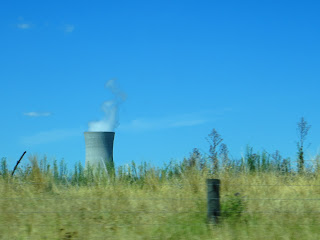
A few days ago, we drove past a nuclear reactor. I took a picture. Today we drove past a huge wind farm. I neglected to take a picture.


Over and out,

Marysa

Volcano Day

Today, we went for a walk in the park.
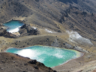
The Emerald Lakes, and steam venting out
of the side of the mountain below.

The park was Tongariro National Park, and the walk was up an active volcano (I am trying very hard not to spell volcano as volcanoe... I don't know why this is so hard for me, but if I slip up, sorry!)

Before volcano-time though, some comments on the names of the towns in the area. The nearest to our hostel is called National Park Village. That's it. That's the name of the town. Hopefully some other village in some other National Park in New Zealand doesn't decide that they want to be called that too, because it doesn't seem very descriptive. And I can't not comment on the village closest to the volcano - Whakapapa - which has a somewhat unfortunate pronunciation when being shouted across a parking lot... moving on!

Rock left behind by pyroclastic flow
The Red Crater
Mt Ngauruhoe
Due to a combination of volcanic activity and congestion, the road up to the two volcanoes in the park is closed, except for shuttles. So we caught our shuttle bright and early (technically it wasn't bright yet) at 6:45, arriving at the well used trail around 7:30. The hike wasn't as long as we expected, but it was very different than the mountains at home. We started off on a gradual slope up a valley filled with several lava flows and deposits from pyroclastic (I had to convince Janna that was a word) flows of old eruptions (the most recent in the late 1800s, I think). The bottom of the valley had some shrubs and flowers and grasses, but the further in we went, the less there was, until the last holdouts of lichen gave way to bare rock. A sign marked what is considered the "alpine" zone - again, very different from what I'm used to. A steep walk up through a few km of bizarre volcanic rocks gave way to an enormous crater - looking around as you crossed it you'd never know you were way up in the air; it felt like a desert. Up a shoulder out of the crater, eventually reaching the turn-around point, from which we could see the Red Crater, the Emerald Lakes, and Blue Lake - and some steam venting out of the side of the bluff below us. This hike is usually a crossing, but the northern half is closed due to a "volcanic eruption hazard".

Also along this hike is Mount Ngauruhoe - more widely know as Mount Doom in the Lord of the Rings. The first half of the hike goes up its bottom half - it takes on its iconic cone-shape at the above mentioned crater of neighbouring Mount Tongariro. Naturally, we took a picture. Or ten.

Okay, this looks like a HUGE bite, but
I swear that's just the angle of the camera...
it really wasn't!!!! (now nobody will believe me...)
In other news, bread here is very thinly sliced, resulting in triple-decker peanut butter and jam sandwiches.

- Marysa

Tuesday, 19 February 2013

February 19th


Couldn't find the Ivanhoe, so took a
picture at the intersection instead :p
Today was a fairly lazy day. We wandered around downtown Rotorua looking for an old hostel, called the Ivanhoe, where Janna's parents once lived for a while. It seems to have disappeared. Or we are really bad finders :p
We then drove out to Lake Taupo, an enormous caldera formed about 27000 years ago (great big lake in the centre of the north island). Draining from Lake Taupo is the Waikato River - suuuuuper vivid colours!
Huka Falls, Waikato River
200 000 litres per second
From there we continued on to Tongariro National Park. We're going for a hike tomorrow, in between Mount Tongariro and Mount Ngauruhoe (more widely known as Mount Doom :p ). There was an eruption here last November which hasn't entirely settled down, so the second half of the trail is still closed (I'll stick up some pictures showing steam/smoke/volcano-breath coming out of the mountain), but we'll do the first half anyhow. We're starting pretty early though, so I'm going to bed!
Cheers,
Marysa

Monday, 18 February 2013

Week One


Hello, hello, hello!
Here is a VERY late start to me keeping you all posted on my great southern adventure!!!! (I intend to do better at updating this in the future :p )

So, the first week in a super-nutshell:

From snowy home I headed to Vancouver and spent a fantastic day-and-a-bit with a few friends out at UBC. Janna met me down there and on Sunday evening we got on an Air New Zealand flight to Auckland. They showed the Hobbit safety video. (http://www.youtube.com/watch?v=XCbPFHu3OOc) I was pretty excited.
I haven't been on a big plane in a long time... the little Pacific Coastal ones that fly to Cranbrook don't take very long to take off; this plane seemed to slowly lumber down the runway... but it did eventually become airborne :) .Landed at 4:30 am on Tuesday morning... 15 hours after Sunday night... thats TIME TRAVEL! Not quite like a Tardis, though...